
Suburb Profile - South Morang
South Morang is located 23 kilometres northeast of Melbourne’s city centre and covers an area of approximately 19 square kilometres.
Before the arrival of European explorers and farmers, the area now called South Morang was inhabited by the Wurundjeri balug and Wurundjeri Willam clans. In 1824, William Hovell and Hamilton Hume were the first Europeans to set foot in what is now the City of Whittlesea. On 14 December 1824, they wrote in their journals:
John Batman, the explorer responsible for founding the settlement on the Yarra River (later to become the City Of Melbourne), settled his pastoral group in South Morang in the 1830’s. By 1840, the area was owned by rich landowners. By the 1850s, the area was used for farming. Lots of evidence of the farming, such as dry stone walls, can still be seen today. In 1852, William Ford Cleeland bought 256 hectares and sundivided and sold the land, doubling his money. Individual land holdings have decreased in size over time. European settlement started from 1870s with the post office opening in November 1873 followed by the first primary school in 1877.
The railway from Melbourne to here was finished in 1889. The old South Morang railway station served the Whittlesea steam railway line until the 1950s. It was further north than the current station.
In 2015 there were an estimated 21,000 people living in South Morang with a 9 per cent increase forecast by 2036 to 23,100. In 2015, 25 per cent of residents were aged between 35 to 49 years.
- Westfield Plenty Valley – https://www.westfield.com.au/plentyvalley
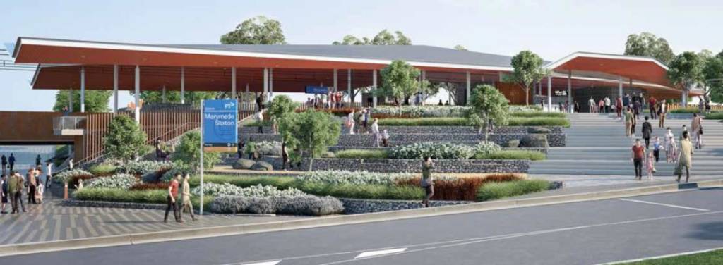
- South Morang & Marymede Train Stations – more info
- Riverside Community Activity Centre – more info
- Plenty Ranges Arts and Convention Centre – https://www.pracc.com.au
- Plenty Ranges Arts and Convention Centre – https://www.pracc.com.au
- Plenty Gorge Park (including Hawkstowe Picnic Area, Middle Gorge Picnic Area, Red Gum Picnic Area, Morang Wetlands, LePage Homestead and Nioka Bush Camp) – more info
- Farm Vigano – http://www.farmvigano.com.au
- Two beans and a farm – http://twobeansandafarm.com.au
- Axis Lifestyle Centre – http://www.axissouthmorang.com.au/home
- Whittlesea Municipal Offices & Civic Centre – more info
- Brolga Park – more info
- South Morang Cricket Club – http://southmorang.vic.cricket.com.au
- Roxy’s Kebab shop – http://roxykebabsmillpark.weebly.com
- Central South Morang Shopping Centre | Your local shopping centre … www.centralsouthmorang.com.au/
- Home Consortium South Morang – cnr mcdonalds & plenty road
- Mill Park Lakes meeting space – more info
- T.U.K.E. Go Kart Track – http://www.f1management.com.au
Schools, Kindergartens and Child Care
- South Morang Preschool – http://www.southmorangpreschool.com.au
- Little Learners – http://www.littlelearners.net.au
- Paradise Kids – http://www.paradisekidscc.com.au
- Morang South Primary School – http://www.morangsouthps.vic.edu.au
- The Lakes South Morang P-9 School – http://www.thelakes.edu.au
- Marymede Catholic College – http://www.marymede.vic.edu.au
- Merriang Special Development School (Junior Campus) – https://www.merriangsds.vic.edu.au
- St Marys College For Hearing Impaired – http://www.smdeafws.catholic.edu.au
Planning and development
The Planned developments within South Morang:
- Proposed South Morang civic precinct
Council is advocating to the state government to invest in a Civic Precinct on the Civic Centre at Ferres Boulevard that potentially includes:
- Magistrates’ Court
- Victorian Civil and Administrative Tribunal
- Victims of Crime Assistance Tribunal
- County Court
- Victoria Police
- Community Correctional Services
- Social services, non-government agencies, businesses and residential development
- Extension of the South Morang train line to Mernda – total cost of $600 million
- Extend of the number 86 tram line from RMIT University Bundoora to the South Morang Transport Hub and then through The Lakes Boulevard to join with Plenty Road.
- Completion of Findon Road between Williamsons Road and Gorge Road in order to ease current traffic congestion and dangerous traffic conditions. Findon Road is the only planned main east-west arterial road north of the Metropolitan Ring Road.
The South Morang Local Structure Plan (1997) guides development within the South Morang area, but can be subject to change. READ IT HERE
Advocacy priorities for South Morang
- Complete Findon Road
- Complete Findon RoadTransport Network
- Duplication of Plenty Road
Council is advocating for the state government to duplicate Plenty Road from Riverdale Boulevard to Bridge Inn Road and install traffic lights at Plenty Road and Bridge Inn Road, Mernda.
- Yan Yean Road duplication: Yarrambat to Doreen
- E6 construction from Metropolitan Ring Road to Bridge Inn Road
- Westfield Entertainment and Leisure Precinct
Westfield are currently develop an entertainment and leisure precinct at their Plenty Valley shopping centre.
The new development is occurring at the western end of the centre, close to South Morang Train Station.
Once completed the precinct will include:
- Village Cinemas complex (featuring Vjunior, Gold Class, Vpremium and Vmax)
- an indoor recreation facility
- an outdoor dining precinct arranged around a piazza area
Redevelopment works are expected to be completed by early 2018. More info here
Sources:
- https://www.whittlesea.vic.gov.au/building-planning-development/future-development-plans/place-snapshots-a-guide-to-development-in-your-area/place-snapshot-south-morang/
- https://en.wikipedia.org/wiki/South_Morang,_Victoria
- https://en.wikipedia.org/wiki/John_Batman
- https://en.wikipedia.org/wiki/Robert_Hoddle

Call
Say hello
Shops 2 and 6, 772-780 High Street, Epping VIC 3076
Copyright © 2023 Ristic Realestate. All Rights Reserved.
Site design & developed by Livelong Digital